Download
View or Print:
Beach Walk &
Nature Trail Maps

|
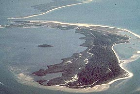
OSPREY TRAIL:
Variable
routes from 1/2 mile to 2 1/2 miles round trip
- Walk along the
Osprey
Trail in the pine flatwoods, which provides visitors with approximately 2-1/2 miles of hiking.
Shorter trips are made by taking one of the many short loop cutoffs. Be
sure to stay on trail and stay out of all posted areas. Restroom at
trailhead only. Look for the signs to take a side trip to
visit Pelican Cove signs. Eagles, Osprey and great Horned Owls are
amoung the nesting birds of prey in these woods. Gopher tortoises,
racoons and armadillos are also seen regularly. This
trail is most popular in fall winter and spring when temperatures are
cooler. Mosquitos are present
during the rainy season, May through October. Wear long pants, long
sleeves and use insect repellent when visiting at these times. Poison Ivy and venomous snakes present year round.
NORTH
BEACH WALK: 4.8
miles round trip
- Park at the
north beach parking lot and hike north 2.4 miles to the sand spit at
the
tip of the island. The North Beach is one of the most breathtaking and
secluded areas in the park. Shelling can be quite good at times. Be
sure
to stay out of sand dunes and all posted areas. Restroom at trailhead
only.
Pets not permitted.
Danger of daily lightning storms in summer. Use Sun Protection. Keep
well hydrated.
SOUTH
BEACH WALK: 1.4
miles round trip
- Park at the
south beach parking lot near the south beach pavilion cafe (double
buildings on beach). The trailhead is located at the new cafe on the
south side of the parking
lot and begins at the boardwalk. Walk uder the cafe building past the
little free library box to find the boardwalk. Hike along the
boardwalk, then head south (left) 1/4
miles to Hurricane Pass and then continue further to the inlet on the
back
side of the south end of the island. Here you will find mature beach
plants, shrubs, cactus, and a mangrove strand and sea grass beds at the
waters edge. The ferry dock is visible across the cove. There is a
small stream that sometimes requires crossing depending on the tides
and amount of rain. At low tide the mudflats are apparent and are
frequented by a variety of shorebirds. This beach is also enjoyed by
fishermen.
Be sure to stay out of all sand dunes and posted areas. Restroom at
beach
parking lot bath house. Pets must be on short leash
and under control at
all times. Pet owners please dispose of all pet waste properly. Pet
wash
area provided.
Powerful tidal currents are present at the pass. Stay out of the water
in areas with dangerous currents. Danger of daily lightning storms in summer. Use Sun Protection. Keep
well hydrated. |